- Home
- Florida North-South Road Trips
FLORIDA ROAD TRIPS
ON NORTH-SOUTH HIGHWAYS
By Mike Miller Updated June 10, 2023
In the old days before the interstates, federal, state and county highways were the only way to get into Florida from the northern states.

Once in Florida, motorists would drive down the peninsula to the beaches on either coast and the central regions.
There was no I-75, I-95 or Florida Turnpike just a couple of generations ago. I have a 1959 road map that shows the way it used to be.
Many of these north-south highways are still very well maintained and are lesser traveled than the interstates.
These routes take you through the places that are still authentic Old Florida.

The routes described in these web pages begin in north Florida and continue south starting with US-1 and State Road A1A on the east coast and US-301 on the west.
Remember that most of these routes get combined with other federal and state highways so the signage can be confusing.
Just keep heading for the towns I've listed and you won't get lost.
The routes we cover here are, in ascending order:
- US-1 and SR-A1A Georgia Border to Jax, Miami and Key West
- US-17 Georgia border north of Jacksonville to Punta Gorda
- SR-17 Haines City south to south of Frostproof
- US-19 Georgia Border to North of Bradenton
- US-27 Georgia border north of Tallahassee to Miami
- US-41 Georgia border north of Jennings to Tampa
- US-98 Alabama border west of Pensacola to Palm Beach
- US-301 Georgia border north of Jacksonville to Sarasota
- US-441 Georgia border north of Lake City to Miami
For no particular reason, I always start with the north end of the trip and proceed south. Needless to say, you can do it the other way around and have just as much fun.
US-1 and State Road A1A from Georgia Border to Miami (382 miles) and Key West (540 miles)


US-1 parallels the route of I-95 at it enters Georgia and extends south all the way through Miami to Key West. State Road A1A is usually on the east side of US-1 and quite often follows the old routes along the Atlantic Ocean.
Although some of the oldest and most historic places in the state are along these two highways, they also have some of the heaviest traffic in Florida.
This doesn't always make for a pleasant driving experience, but you will see a lot of Old Florida as well as a lot of new. The three maps above show the routes and how you can get on and off I-95.
Places you will see along the way (the links always take you to the town's page on our website):
Fernandina Beach - Mayport - Jacksonville - St. Augustine - Ormond Beach - Daytona Beach - Ponce Inlet - New Smyrna Beach - Oak Hill - Mims - Canaveral National Seashore - Titusville - Cocoa - Indialantic - Melbourne - Sebastian - Vero Beach - Fort Pierce - Stuart - Jupiter - Juno Beach - Palm Beach - Boynton Beach - Delray Beach - Boca Raton - Deerfield Beach - Pompano Beach - Lauderdale by the Sea - Fort Lauderdale - Hollywood - Surfside - Miami - Coconut Grove - Coral Gables - Homestead - Bahia Honda - Key West
More details about the towns are on this page:
OLD FLORIDA TOWNS ON STATE ROAD A1A and US-1 FROM FERNANDINA BEACH TO MIAMI AND KEY WEST
US-17 Georgia Border to Punta Gorda: 317 Miles
In the old days, this was one way to travel from the interior of Florida up north to Savannah, Hilton Head Island and all the way up to Winchester Virginia. It hugs the coast as it winds through Georgia, South Carolina and North Carolina and was known as the Seaboard Air Highway in olden times.
In Florida, it enters the state north of Jacksonville at the St. Mary's River and winds through some very interesting scenery, including some major cities. The route is largely rural however, but those major cities do slow you down somewhat. But I still like to go that way and see signs of Old Florida even in the big metropolitan places.
Yulee - Jacksonville - Orange Park - Green Cove Springs - Palatka - East Palatka - San Mateo - Satsuma - Crescent City - Seville - Barberville - DeLeon Springs - DeLand - Orange City - DeBary - Sanford - Lake Mary - Winter Springs - Casselberry - Altamonte Springs - Maitland - Winter Park - Orlando - Kissimmee - Campbell - Loughman - Davenport - Haines City - Lake Alfred - Winter Haven - Bartow - Fort Meade - Bowling Green - Wauchula - Zolfo Springs - Arcadia - Fort Ogden - Punta Gorda
This link will show you 6 of these cities on a single web page:
OLD FLORIDA TOWNS ON US-17 SOUTH OF I-4
SR-17 Haines City to Frostproof: 38.7 Miles

State Road 17 is also known as Scenic 17 or the Ridge Scenic Highway. It is in Polk County and is just east of the busier US-27. It meanders through rolling citrus groves studded with hundreds of lakes.
Some of the towns along the way are Haines City, Lake Wales, Lake Hamilton, Dundee, Highland Park, Babson Park and Frostproof.
Some of these towns are described here:
OLD FLORIDA TOWNS ON SCENIC HIGHWAY 17
US-19 Georgia Border to North of Bradenton: 270 Miles

This route is mainly authentic Old Florida as you enter from the Georgia border and head south through Monticello and other quiet towns. When you get further south it becomes more and more congested from south of Weeki Wachee on into the urban metropolis of Pinellas County with Clearwater and St. Petersburg. You won't mind this congestion so much when you emerge onto the beautiful Sunshine Skyway bridge across Tampa bay and on down into Memphis and Palmetto.
Some towns along the way are:
Monticello - Perry - Cross City - Fanning Springs - Chiefland - Yankeetown and Inglis - Crystal River - Homosassa Springs - Weeki Wachee - New Port Richey - Tarpon Springs - Dunedin - Clearwater - St. Petersburg - Memphis
US-27 Georgia Border to Miami: 496 Miles

This is a historic north-south route that follows the high ridge of central Florida all the way down to Miami. It starts in the North at the Georgia border just north of the old tobacco town of Havana, Florida. It was one of Florida's first "super highways" in the days before the Interstates.
It is four-laned for much of its route, with congestion only now and then in the urban areas near Tallahassee, Ocala, The Villages, Haines City, Hialeah and Miami. I have driven the entire route in both directions, both in the days before the interstates and recently.
I've seen the groves get frozen out in Central Florida and move to the areas south of Lake Wales and down to Lake Placid. You go through some Everglades farm towns and have plenty of opportunities along the way to enjoy small towns and quiet sights. You cross the interstates and the turnpike a couple of times, but in general, you will be in the country.
Havana - Tallahassee - Capps - Perry - Mayo - Branford - Fort White - High Springs - Newberry - Archer - Ocala - Belleview - The Villages - Fruitland Park - Leesburg - Minneola - Clermont - Haines City - Lake Wales - Frostproof - Avon Park - Sebring - Lake Placid - Palmdale - Moore Haven - Clewiston - South Bay - Andytown - Weston - Hialeah - Miami
Some of these towns are described in detail here:
OLD FLORIDA TOWNS ON US-27 FROM GEORGIA BORDER TO MIAMI
US-41 Georgia Border to Tampa: 212 Miles

US-41 is a major federal highway on the west side of Florida that parallels I-75 for most of its route. In the pre-interstate days this highway funneled people from the Midwestern states into Florida. This is why the west coast of Florida still has a somewhat Midwestern flavor. US-1 on the east coast of Florida brought down people from New York, New Jersey and the New England states.
We have included only a portion of US-41, the section from the Georgia border down to Tampa. South of Tampa it is so congested it's no fun to drive any more.
Some of the towns you will go through include:
Jennings - Jasper - White Springs - Lake City - High Springs - Newberry - Williston - Morriston - Dunnellon - Inverness - Floral City - Brooksville - Land O Lakes - Lutz - Tampa
This page gives you more details on the towns involved:
OLD FLORIDA TOWNS ON US-41 FROM GEORGIA TO TAMPA
US-98 Alabama Border to Palm Beach: 600 Miles

This is an old route that comes into the state from Alabama just west of Pensacola and meanders along the Gulf of Mexico in an easterly direction until it reaches Perry and starts its journey in a southeasterly direction down to Palm Beach. It ends at SR-A1A adjacent to Donald Trump's place, "Mar A Lago".
You'll go through a few congested places but in general you will get a great look at Old Florida. Some of the towns you will go through are:
Pensacola - Fort Walton Beach - Destin - Seaside - Panama City - Mexico Beach - Port St Joe - Apalachicola - Carrabelle - Panacea - Perry - Crystal River - Homosassa - Brooksville - Dade City - Lakeland - Lake Wales - Avon Park - Sebring - Okeechobee - Palm Beach
Three of these towns are described on
OLD FLORIDA TOWNS ON THE FORGOTTEN COAST
US-301 Georgia Border to Sarasota: 269 Miles

This historic route was also one of Florida's first "super highways" and is four-laned in many sections. It starts at the St. Marys River on the Georgia border and goes through many old Florida towns that the interstates have bypassed. Some of these little towns are pretty drab; others are good places to stop and eat or sleep and look at the sights.
Island Grove isn't far from Cross Creek and is the site of Antioch Cemetery where the famous writer Marjorie Kinnan Rawlings is buried. Traffic is usually pretty light along the mostly rural route. It does get congested now and then as you get into the Tampa metro area and on into Sarasota. But you will see a lot of Old Florida along the way.
Hilliard - Callahan - Baldwin - Lawtey - Starke - Waldo - Hawthorne - Island Grove - Citra - Ocala - Belleview - The Villages - Wildwood - Coleman - Sumterville - Bushnell - Dade City - Zephyrhills - Temple Terrace - Tampa - Riverview - Sun City Center - Parrish - Ellenton - Palmetto - Bradenton - Sarasota
Some of these towns are described in detail here:
OLD FLORIDA TOWNS ON US-301 GEORGIA TO SARASOTA
US-441 Georgia Border to Miami: 433 Miles

This highway comes into Florida at the Georgia border about 25 miles north of Lake City. The highway shares signage with many other highways on its way down to Miami. Sometimes it is combined with US-301, US-27, SR-80 and several other multi-signed segments. Just keep track of the towns we list and you won't get lost.
When the road enters into the urban areas of Palm Beach, Broward and Miami-Dade Counties it is often known by locals as State Road 7. It ends at Tamiami Trail in Miami.
The northern reaches of this highway are rural piney woods Florida until you get to the urban and university center of Gainesville. Between Gainesville and Ocala you cross a natural marshy preserve called Payne's Prairie and can drop in on the quaint little villages of Micanopy and McIntosh.
Once you get to Leesburg, traffic is pretty heavy on into Orlando and through that city to Kissimmee and St. Cloud. In Orlando the route is known as Orange Blossom Trail. Once you get through St. Cloud you are in cattle country again and when you turn south at Holopaw you will have many miles of wilderness until you get to Okeechobee. Then you head east into the urban centers along the coast.
As in other areas, I've driven all segments of this highway even in the urban areas. It is still more like the Old Florida I remember than the Interstate routes. For most people, however, driving in the urban segments is optional.
Lake City - High Springs - Alachua - Gainesville - Micanopy - McIntosh - Orange Lake - Ocala - Belleview - The Villages - Lady Lake - Fruitland Park - Leesburg - Tavares - Eustis - Mount Dora - Tangerine - Zellwood - Apopka - Lockhart - Orlando - Kissimmee - St. Cloud - Holopaw - Yeehaw Junction - Okeechobee - Port Mayaca - Canal Point - Pahokee - Belle Glade - Wellington - Coral Springs - Coconut Creek - Margate - Lauderdale Lakes - Fort Lauderdale - Hollywood - Miami Gardens - Miami
Our Facebook page has more than 130,000 followers who love off the beaten path Florida: towns, tourist attractions, maps, lodging, food, festivals, scenic road trips, day trips, history, culture, nostalgia, and more. We post articles every day. Please check it out and if you like it, we would appreciate a "like" from you.
By Mike Miller, Copyright 2009-2024
Florida-Back-Roads-Travel.com
Florida Back Roads Travel is not affiliated with or endorsed by Backroads, a California-based tour operator which arranges and conducts travel programs throughout the world.
Recent Articles
-
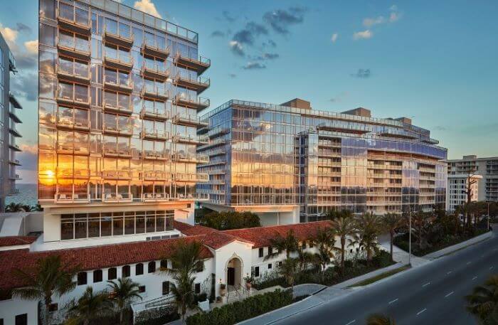
Surfside, Florida. Home of the Famous Surf Club
Apr 24, 24 06:16 PM
 Surfside, Florida is a small town of 6,000 located between Miami Beach and Bal Harbour.